Stratospheric Profiles

Figure description

Comparisons between ECMWF reanalysis (ERA-Interim) product and nightly averaged Rayleigh lidar measurements versus altitude during the OHP campaign. For the selected time period, the mean and standard deviation of the model and measurements can be displayed. Individual profiles can also be superimposed.

ERA-Interim data and ERA5 are generated using Copernicus Climate Change Service Information (https://climate.copernicus.eu/products/climate-reanalysis)

Data are provided by LATMOS: A. Hauchecorne and P. Keckhut

Stratospheric Profiles

Context

High-resolution lidar stations part of the Network for the Detection of Atmospheric Change (NDACC) are used to evaluate the accuracy of weather and climate models in the middle atmosphere at northern hemisphere mid-latitudes. Historical recordings of the NDACC lidar station at Observatoire Haute-Provence (OHP) are here used for evaluating the atmospheric state computed by the European Centre for Medium-Range Weather Forecasts (ECMWF) at 40 km and above.

ECMWF reanalyses are broadly consistent with lidar measurements up to ~40 km. Deviations increase with altitude as the assimilated observations become sparser. Above 45 km altitude, within the sponge layer of the Integrated Forecast System (IFS), model data sets depict lower temperatures than the observations. Between 40 and 60 km altitude, comparisons highlight differences increasing with altitude where limited data assimilation occurs operationally. The largest deviations are observed in winter when the variability from large-scale planetary waves dominates.

As such, this study demonstrates the potential of the ARISE project that integrates various measurements and provides a quantitative understanding of stratosphere-troposphere dynamical coupling for numerical weather prediction applications.


Stations

Lidar-station-OHP
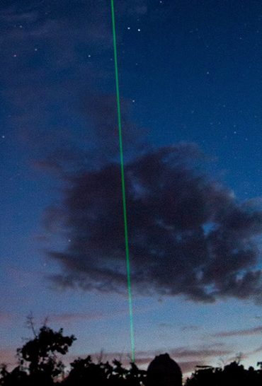
Lidar station at Observatoire de Haute Provence, France (43.94N, 5.71E). Courtesy of: Nicolau Wallenstein

The NDAAC provides lidar measurements of the stratospheric temperature and wind. Rayleigh lidars are well adapted to the study of planetary, gravity waves and tides in the upper stratosphere and mesosphere as well as their interaction to induce mesospheric inversions. A Rayleigh-Doppler wind lidar is developed to measure the horizontal wind in the stratosphere and in the upper troposphere. Both lidar technologies are used at OHP and at the Maïdo observatory (Reunion Island).

References

  • Angot, G. et al. (2012), Contribution of stratospheric warmings on temperature trends in the middle atmosphere from the lidar series obtained at observatory of Haute-Provence, J. Geophys. Res., 117D21 https://doi.org/10.1029/2012JD017631
  • Le Pichon, A., et al. (2015), Comparison of co-located independent ground-based middle atmospheric wind and temperature measurements with numerical weather prediction models, J. Geophys. Res. Atmos., 120, https://doi.org/10.1002/2015JD023273
  • Khaykin, S. et al. (2015), Seasonal variation of gravity wave activity at mid-latitudes from 7 years of cosmic gps and Rayleigh lidar temperature observations, Geophys. Res. Lett., 42(4), 1251-1258. https://doi.org/10.1002/2014GL062891
  • Ehard, B. et al. (2017), Comparing ECMWF high resolution analyses to lidar temperature measurements in the middle atmosphere, Quart. J. Roy. Meteor. Soc., doi: 10.1002/qj.3206. https://doi.org/10.1002/qj.3206
  • Credits background-image : Gerd Baumgarten